Drone Photography Service Benefits
FAA Certified Drone Photography — $149
Show buyers a perspective they simply cannot get from ground-level photography.
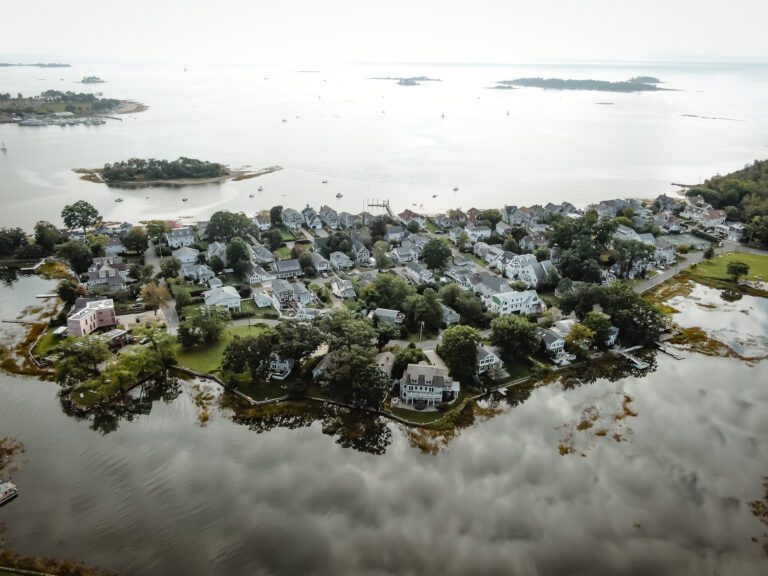
Harborview – South Norwalk, CT
Why use Drone Images?
View our work, over 30 Drone images on this page.
Inspections
Surveys
Insurance
Residential Real Estate
Commercial Real Estate
Industrial Real Estate
Historical purposes
Legal use
Borders/Boundaries
Neighborhood areas
Why Add Drone Photography?
Show the Entire Property
Drone photography helps buyers understand the overall layout of the property, including the home, yard, driveway, landscaping, and surrounding features.
Highlight Location Advantages
Aerial photography can showcase nearby amenities such as:
• Waterfront locations
• Golf courses
• Parks and trails
• Beaches
• Downtown districts
• Schools
• Transportation access
Create More Buyer Interest
Listings with aerial photography often attract more attention because they stand out from competing properties.
Demonstrate Property Size
Ground-level photos can make it difficult to appreciate lot size. Drone photography provides perspective that helps buyers understand the full scope of the property.
Showcase Outdoor Living Areas
Highlight:
• Pools
• Patios
• Decks
• Outdoor kitchens
• Gardens
• Recreational areas
Perfect for Larger Properties
Drone photography is particularly effective for:
• Estate properties
• Acreage
• Waterfront homes
• Luxury homes
• Properties with unique settings
Professional Marketing Advantage
Aerial images create a premium marketing presentation that helps distinguish your property from competing listings.
Easy To Share
Drone photos can be:
• Included in MLS listings
• Shared on social media
• Used in brochures
• Added to virtual tours
• Emailed to buyers
• Texted to prospects
Key Benefits
✓ Show the entire property
✓ Highlight location and surroundings
✓ Demonstrate lot size
✓ Showcase outdoor features
✓ Increase online engagement
✓ Create a premium presentation
✓ Easy to share and market
✓ Captured by an FAA Certified Drone Pilot
Why Use Our Service?
Unlike many flat-fee MLS providers, drone photography is performed locally by a Connecticut licensed broker who understands how to market real estate, not just fly a drone.
The goal is not simply to take aerial pictures. The goal is to create marketing images that help buyers understand the property’s value and generate greater interest in the home.